
Static Map Catalogue - Product List
back to previous node |
list of download URLs

Collection ALOS_Africa_AVNIR2
ALOS AVNIR-2 African Coverage ESA archive. More information can be found on this page.
List of available products (latitude from 29.0722 to 29.9278 dg, longitude from 31.8625 to 32.8708 dg)..
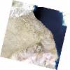
AL1_OPER_AV2_OBS_11_20070523T083846_20070523T083856_007064_0265_3010_0000
Download Product | Browse
wrsLongitudeGrid | 265 |
wrsLatitudeGrid | 3010 |
beginAcquisition | 2007-05-23T08:38:46.599Z |
endAcquisition | 2007-05-23T08:38:56.959Z |
productType | AV2_OBS_11 |
instrumentShortName | AVNIR-2 |
operationalMode | OBS |
orbitNumber | 7064 |
orbitDirection | DESCENDING |
sceneCentre | 29.340 32.371 |
acquisitionStation | SGS |
cloudCoverPercentage | 0 |
sceneId | AV2A070643010 |
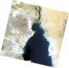
AL1_OPER_AV2_OBS_11_20070523T083838_20070523T083848_007064_0265_3000_0000
Download Product | Browse
wrsLongitudeGrid | 265 |
wrsLatitudeGrid | 3000 |
beginAcquisition | 2007-05-23T08:38:38.383Z |
endAcquisition | 2007-05-23T08:38:48.743Z |
productType | AV2_OBS_11 |
instrumentShortName | AVNIR-2 |
operationalMode | OBS |
orbitNumber | 7064 |
orbitDirection | DESCENDING |
sceneCentre | 29.833 32.499 |
acquisitionStation | SGS |
cloudCoverPercentage | 0 |
sceneId | AV2A070643000 |
AL1_OPER_AV2_OBS_11_20070725T084040_20070725T084050_007983_0266_3000_0000
Download Product | Browse
wrsLongitudeGrid | 266 |
wrsLatitudeGrid | 3000 |
beginAcquisition | 2007-07-25T08:40:40.330Z |
endAcquisition | 2007-07-25T08:40:50.690Z |
productType | AV2_OBS_11 |
instrumentShortName | AVNIR-2 |
operationalMode | OBS |
orbitNumber | 7983 |
orbitDirection | DESCENDING |
sceneCentre | 29.833 31.967 |
acquisitionStation | SGS |
cloudCoverPercentage | 0 |
sceneId | AV2A079833000 |