
Static Map Catalogue - Product List
back to previous node |
list of download URLs


Collection ALOS_Africa_AVNIR2
ALOS AVNIR-2 African Coverage ESA archive. More information can be found on this page.
List of available products (latitude from 23.2185 to 24.1148 dg, longitude from -16.0438 to -15.0813 dg)..
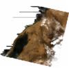
AL1_OPER_AV2_OBS_11_20061110T114400_20061110T114411_004236_0351_3120_0000
Download Product | Browse
wrsLongitudeGrid | 351 |
wrsLatitudeGrid | 3120 |
beginAcquisition | 2006-11-10T11:44:00.817Z |
endAcquisition | 2006-11-10T11:44:11.177Z |
productType | AV2_OBS_11 |
instrumentShortName | AVNIR-2 |
operationalMode | OBS |
orbitNumber | 4236 |
orbitDirection | DESCENDING |
sceneCentre | 23.885 -15.095 |
acquisitionStation | SGS |
cloudCoverPercentage | 0 |
sceneId | AV2A042363120 |
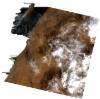
AL1_OPER_AV2_OBS_11_20061110T114409_20061110T114419_004236_0351_3130_0000
Download Product | Browse
wrsLongitudeGrid | 351 |
wrsLatitudeGrid | 3130 |
beginAcquisition | 2006-11-10T11:44:09.035Z |
endAcquisition | 2006-11-10T11:44:19.395Z |
productType | AV2_OBS_11 |
instrumentShortName | AVNIR-2 |
operationalMode | OBS |
orbitNumber | 4236 |
orbitDirection | DESCENDING |
sceneCentre | 23.389 -15.214 |
acquisitionStation | SGS |
cloudCoverPercentage | 0 |
sceneId | AV2A042363130 |
AL1_OPER_AV2_OBS_11_20070112T114647_20070112T114657_005155_0352_3120_0000
Download Product | Browse
wrsLongitudeGrid | 352 |
wrsLatitudeGrid | 3120 |
beginAcquisition | 2007-01-12T11:46:47.514Z |
endAcquisition | 2007-01-12T11:46:57.874Z |
productType | AV2_OBS_11 |
instrumentShortName | AVNIR-2 |
operationalMode | OBS |
orbitNumber | 5155 |
orbitDirection | DESCENDING |
sceneCentre | 23.886 -15.666 |
acquisitionStation | SGS |
cloudCoverPercentage | 2 |
sceneId | AV2A051553120 |
AL1_OPER_AV2_OBS_11_20070112T114655_20070112T114706_005155_0352_3130_0000
Download Product | Browse
wrsLongitudeGrid | 352 |
wrsLatitudeGrid | 3130 |
beginAcquisition | 2007-01-12T11:46:55.731Z |
endAcquisition | 2007-01-12T11:47:06.091Z |
productType | AV2_OBS_11 |
instrumentShortName | AVNIR-2 |
operationalMode | OBS |
orbitNumber | 5155 |
orbitDirection | DESCENDING |
sceneCentre | 23.390 -15.785 |
acquisitionStation | SGS |
cloudCoverPercentage | 4 |
sceneId | AV2A051553130 |