
Static Map Catalogue - Product List
back to previous node |
list of download URLs
Collection ALOS_Africa_AVNIR2
ALOS AVNIR-2 African Coverage ESA archive. More information can be found on this page.
List of available products (latitude from 16.7815 to 17.6778 dg, longitude from -16.0438 to -15.0813 dg)..
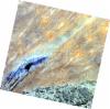
AL1_OPER_AV2_OBS_11_20071108T113940_20071108T113950_009531_0348_3260_0000
Download Product | Browse
wrsLongitudeGrid | 348 |
wrsLatitudeGrid | 3260 |
beginAcquisition | 2007-11-08T11:39:40.434Z |
endAcquisition | 2007-11-08T11:39:50.794Z |
productType | AV2_OBS_11 |
instrumentShortName | AVNIR-2 |
operationalMode | OBS |
orbitNumber | 9531 |
orbitDirection | DESCENDING |
sceneCentre | 16.933 -15.123 |
acquisitionStation | SGS |
cloudCoverPercentage | 0 |
sceneId | AV2A095313260 |
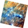
AL1_OPER_AV2_OBS_11_20090715T114334_20090715T114345_018502_0349_3250_0000
Download Product | Browse
wrsLongitudeGrid | 349 |
wrsLatitudeGrid | 3250 |
beginAcquisition | 2009-07-15T11:43:34.872Z |
endAcquisition | 2009-07-15T11:43:45.232Z |
productType | AV2_OBS_11 |
instrumentShortName | AVNIR-2 |
operationalMode | OBS |
orbitNumber | 18502 |
orbitDirection | DESCENDING |
sceneCentre | 17.430 -15.539 |
acquisitionStation | SGS |
cloudCoverPercentage | 0 |
sceneId | AV2A185023250 |
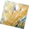
AL1_OPER_AV2_OBS_11_20090715T114343_20090715T114353_018502_0349_3260_0000
Download Product | Browse
wrsLongitudeGrid | 349 |
wrsLatitudeGrid | 3260 |
beginAcquisition | 2009-07-15T11:43:43.091Z |
endAcquisition | 2009-07-15T11:43:53.451Z |
productType | AV2_OBS_11 |
instrumentShortName | AVNIR-2 |
operationalMode | OBS |
orbitNumber | 18502 |
orbitDirection | DESCENDING |
sceneCentre | 16.933 -15.651 |
acquisitionStation | SGS |
cloudCoverPercentage | 0 |
sceneId | AV2A185023260 |