
Static Map Catalogue - Product List
back to previous node |
list of download URLs


Collection ALOS_Africa_AVNIR2
ALOS AVNIR-2 African Coverage ESA archive. More information can be found on this page.
List of available products (latitude from 12.3296 to 13.2259 dg, longitude from 21.6292 to 22.6375 dg)..
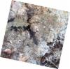
AL1_OPER_AV2_OBS_11_20070826T090649_20070826T090700_008450_0276_3350_0000
Download Product | Browse
wrsLongitudeGrid | 276 |
wrsLatitudeGrid | 3350 |
beginAcquisition | 2007-08-26T09:06:49.983Z |
endAcquisition | 2007-08-26T09:07:00.343Z |
productType | AV2_OBS_11 |
instrumentShortName | AVNIR-2 |
operationalMode | OBS |
orbitNumber | 8450 |
orbitDirection | DESCENDING |
sceneCentre | 12.456 22.516 |
acquisitionStation | SGS |
cloudCoverPercentage | 0 |
sceneId | AV2A084503350 |
AL1_OPER_AV2_OBS_11_20080111T090541_20080111T090551_010463_0276_3340_0000
Download Product | Browse
wrsLongitudeGrid | 276 |
wrsLatitudeGrid | 3340 |
beginAcquisition | 2008-01-11T09:05:41.176Z |
endAcquisition | 2008-01-11T09:05:51.536Z |
productType | AV2_OBS_11 |
instrumentShortName | AVNIR-2 |
operationalMode | OBS |
orbitNumber | 10463 |
orbitDirection | DESCENDING |
sceneCentre | 12.954 22.620 |
acquisitionStation | SGS |
cloudCoverPercentage | 0 |
sceneId | AV2A104633340 |
AL1_OPER_AV2_OBS_11_20080111T090549_20080111T090559_010463_0276_3350_0000
Download Product | Browse
wrsLongitudeGrid | 276 |
wrsLatitudeGrid | 3350 |
beginAcquisition | 2008-01-11T09:05:49.397Z |
endAcquisition | 2008-01-11T09:05:59.757Z |
productType | AV2_OBS_11 |
instrumentShortName | AVNIR-2 |
operationalMode | OBS |
orbitNumber | 10463 |
orbitDirection | DESCENDING |
sceneCentre | 12.456 22.511 |
acquisitionStation | SGS |
cloudCoverPercentage | 0 |
sceneId | AV2A104633350 |