
Static Map Catalogue - Product List
back to previous node |
list of download URLs

Collection ALOS_Africa_AVNIR2
ALOS AVNIR-2 African Coverage ESA archive. More information can be found on this page.
List of available products (latitude from 7.44074 to 8.33704 dg, longitude from 44.1187 to 45.0812 dg)..
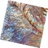
AL1_OPER_AV2_OBS_11_20071230T073254_20071230T073304_010287_0232_3450_0000
Download Product | Browse
wrsLongitudeGrid | 232 |
wrsLatitudeGrid | 3450 |
beginAcquisition | 2007-12-30T07:32:54.597Z |
endAcquisition | 2007-12-30T07:33:04.957Z |
productType | AV2_OBS_11 |
instrumentShortName | AVNIR-2 |
operationalMode | OBS |
orbitNumber | 10287 |
orbitDirection | DESCENDING |
sceneCentre | 7.477 45.038 |
acquisitionStation | SGS |
cloudCoverPercentage | 0 |
sceneId | AV2A102873450 |
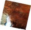
AL1_OPER_AV2_OBS_11_20080116T073443_20080116T073453_010535_0233_3440_0000
Download Product | Browse
wrsLongitudeGrid | 233 |
wrsLatitudeGrid | 3440 |
beginAcquisition | 2008-01-16T07:34:43.084Z |
endAcquisition | 2008-01-16T07:34:53.444Z |
productType | AV2_OBS_11 |
instrumentShortName | AVNIR-2 |
operationalMode | OBS |
orbitNumber | 10535 |
orbitDirection | DESCENDING |
sceneCentre | 7.975 44.613 |
acquisitionStation | SGS |
cloudCoverPercentage | 0 |
sceneId | AV2A105353440 |
AL1_OPER_AV2_OBS_11_20080116T073451_20080116T073501_010535_0233_3450_0000
Download Product | Browse
wrsLongitudeGrid | 233 |
wrsLatitudeGrid | 3450 |
beginAcquisition | 2008-01-16T07:34:51.306Z |
endAcquisition | 2008-01-16T07:35:01.666Z |
productType | AV2_OBS_11 |
instrumentShortName | AVNIR-2 |
operationalMode | OBS |
orbitNumber | 10535 |
orbitDirection | DESCENDING |
sceneCentre | 7.477 44.506 |
acquisitionStation | SGS |
cloudCoverPercentage | 0 |
sceneId | AV2A105353450 |