
Static Map Catalogue - Product List
back to previous node |
list of download URLs

Collection ALOS_Africa_AVNIR2
ALOS AVNIR-2 African Coverage ESA archive. More information can be found on this page.
List of available products (latitude from 1.65556 to 2.55185 dg, longitude from 44.1187 to 45.0812 dg)..
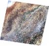
AL1_OPER_AV2_OBS_11_20070223T073100_20070223T073110_005765_0230_3550_0000
Download Product | Browse
wrsLongitudeGrid | 230 |
wrsLatitudeGrid | 3550 |
beginAcquisition | 2007-02-23T07:31:00.057Z |
endAcquisition | 2007-02-23T07:31:10.417Z |
productType | AV2_OBS_11 |
instrumentShortName | AVNIR-2 |
operationalMode | OBS |
orbitNumber | 5765 |
orbitDirection | DESCENDING |
sceneCentre | 2.496 45.058 |
acquisitionStation | SGS |
cloudCoverPercentage | 0 |
sceneId | AV2A057653550 |
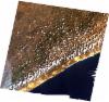
AL1_OPER_AV2_OBS_11_20070223T073108_20070223T073118_005765_0230_3560_0000
Download Product | Browse
wrsLongitudeGrid | 230 |
wrsLatitudeGrid | 3560 |
beginAcquisition | 2007-02-23T07:31:08.282Z |
endAcquisition | 2007-02-23T07:31:18.642Z |
productType | AV2_OBS_11 |
instrumentShortName | AVNIR-2 |
operationalMode | OBS |
orbitNumber | 5765 |
orbitDirection | DESCENDING |
sceneCentre | 1.998 44.952 |
acquisitionStation | SGS |
cloudCoverPercentage | 1 |
sceneId | AV2A057653560 |
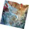
AL1_OPER_AV2_OBS_11_20071213T073216_20071213T073226_010039_0231_3550_0000
Download Product | Browse
wrsLongitudeGrid | 231 |
wrsLatitudeGrid | 3550 |
beginAcquisition | 2007-12-13T07:32:16.489Z |
endAcquisition | 2007-12-13T07:32:26.849Z |
productType | AV2_OBS_11 |
instrumentShortName | AVNIR-2 |
operationalMode | OBS |
orbitNumber | 10039 |
orbitDirection | DESCENDING |
sceneCentre | 2.495 44.522 |
acquisitionStation | SGS |
cloudCoverPercentage | 0 |
sceneId | AV2A100393550 |
AL1_OPER_AV2_OBS_11_20071213T073224_20071213T073235_010039_0231_3560_0000
Download Product | Browse
wrsLongitudeGrid | 231 |
wrsLatitudeGrid | 3560 |
beginAcquisition | 2007-12-13T07:32:24.713Z |
endAcquisition | 2007-12-13T07:32:35.073Z |
productType | AV2_OBS_11 |
instrumentShortName | AVNIR-2 |
operationalMode | OBS |
orbitNumber | 10039 |
orbitDirection | DESCENDING |
sceneCentre | 1.997 44.417 |
acquisitionStation | SGS |
cloudCoverPercentage | 0 |
sceneId | AV2A100393560 |