
Static Map Catalogue - Product List
back to previous node |
list of download URLs

Collection ALOS_Africa_AVNIR2
ALOS AVNIR-2 African Coverage ESA archive. More information can be found on this page.
List of available products (latitude from -2.55185 to -1.65556 dg, longitude from 28.8708 to 29.8792 dg)..
AL1_OPER_AV2_OBS_11_20070825T083002_20070825T083012_008435_0257_3640_0000
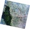
Download Product | Browse
wrsLongitudeGrid | 257 |
wrsLatitudeGrid | 3640 |
beginAcquisition | 2007-08-25T08:30:02.162Z |
endAcquisition | 2007-08-25T08:30:12.522Z |
productType | AV2_OBS_11 |
instrumentShortName | AVNIR-2 |
operationalMode | OBS |
orbitNumber | 8435 |
orbitDirection | DESCENDING |
sceneCentre | -1.989 29.626 |
acquisitionStation | SGS |
cloudCoverPercentage | 1 |
sceneId | AV2A084353640 |
AL1_OPER_AV2_OBS_11_20070825T083010_20070825T083020_008435_0257_3650_0000
Download Product | Browse
wrsLongitudeGrid | 257 |
wrsLatitudeGrid | 3650 |
beginAcquisition | 2007-08-25T08:30:10.388Z |
endAcquisition | 2007-08-25T08:30:20.748Z |
productType | AV2_OBS_11 |
instrumentShortName | AVNIR-2 |
operationalMode | OBS |
orbitNumber | 8435 |
orbitDirection | DESCENDING |
sceneCentre | -2.488 29.520 |
acquisitionStation | SGS |
cloudCoverPercentage | 0 |
sceneId | AV2A084353650 |