
Static Map Catalogue - Product List
back to previous node |
list of download URLs


Collection ALOS_Africa_AVNIR2
ALOS AVNIR-2 African Coverage ESA archive. More information can be found on this page.
List of available products (latitude from -4.34444 to -3.44815 dg, longitude from 29.1125 to 30.1208 dg)..
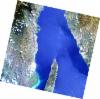
AL1_OPER_AV2_OBS_11_20070808T082829_20070808T082839_008187_0256_3680_0000
Download Product | Browse
wrsLongitudeGrid | 256 |
wrsLatitudeGrid | 3680 |
beginAcquisition | 2007-08-08T08:28:29.457Z |
endAcquisition | 2007-08-08T08:28:39.817Z |
productType | AV2_OBS_11 |
instrumentShortName | AVNIR-2 |
operationalMode | OBS |
orbitNumber | 8187 |
orbitDirection | DESCENDING |
sceneCentre | -3.982 29.738 |
acquisitionStation | SGS |
cloudCoverPercentage | 1 |
sceneId | AV2A081873680 |
AL1_OPER_AV2_OBS_11_20070825T083026_20070825T083037_008435_0257_3670_0000
Download Product | Browse
wrsLongitudeGrid | 257 |
wrsLatitudeGrid | 3670 |
beginAcquisition | 2007-08-25T08:30:26.840Z |
endAcquisition | 2007-08-25T08:30:37.200Z |
productType | AV2_OBS_11 |
instrumentShortName | AVNIR-2 |
operationalMode | OBS |
orbitNumber | 8435 |
orbitDirection | DESCENDING |
sceneCentre | -3.483 29.309 |
acquisitionStation | SGS |
cloudCoverPercentage | 0 |
sceneId | AV2A084353670 |
AL1_OPER_AV2_OBS_11_20070825T083035_20070825T083045_008435_0257_3680_0000
Download Product | Browse
wrsLongitudeGrid | 257 |
wrsLatitudeGrid | 3680 |
beginAcquisition | 2007-08-25T08:30:35.066Z |
endAcquisition | 2007-08-25T08:30:45.426Z |
productType | AV2_OBS_11 |
instrumentShortName | AVNIR-2 |
operationalMode | OBS |
orbitNumber | 8435 |
orbitDirection | DESCENDING |
sceneCentre | -3.982 29.203 |
acquisitionStation | SGS |
cloudCoverPercentage | 0 |
sceneId | AV2A084353680 |