
Static Map Catalogue - Product List
back to previous node |
list of download URLs


Collection ALOS_Africa_AVNIR2
ALOS AVNIR-2 African Coverage ESA archive. More information can be found on this page.
List of available products (latitude from -4.34444 to -3.44815 dg, longitude from 29.8792 to 30.8875 dg)..
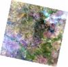
AL1_OPER_AV2_OBS_11_20060817T082232_20060817T082243_002994_0254_3680_0000
Download Product | Browse
wrsLongitudeGrid | 254 |
wrsLatitudeGrid | 3680 |
beginAcquisition | 2006-08-17T08:22:32.832Z |
endAcquisition | 2006-08-17T08:22:43.192Z |
productType | AV2_OBS_11 |
instrumentShortName | AVNIR-2 |
operationalMode | OBS |
orbitNumber | 2994 |
orbitDirection | DESCENDING |
sceneCentre | -3.982 30.820 |
acquisitionStation | SGS |
cloudCoverPercentage | 0 |
sceneId | AV2A029943680 |
AL1_OPER_AV2_OBS_11_20061019T082518_20061019T082529_003913_0255_3670_0000
Download Product | Browse
wrsLongitudeGrid | 255 |
wrsLatitudeGrid | 3670 |
beginAcquisition | 2006-10-19T08:25:18.935Z |
endAcquisition | 2006-10-19T08:25:29.295Z |
productType | AV2_OBS_11 |
instrumentShortName | AVNIR-2 |
operationalMode | OBS |
orbitNumber | 3913 |
orbitDirection | DESCENDING |
sceneCentre | -3.485 30.391 |
acquisitionStation | SGS |
cloudCoverPercentage | 0 |
sceneId | AV2A039133670 |
AL1_OPER_AV2_OBS_11_20061019T082527_20061019T082537_003913_0255_3680_0000
Download Product | Browse
wrsLongitudeGrid | 255 |
wrsLatitudeGrid | 3680 |
beginAcquisition | 2006-10-19T08:25:27.161Z |
endAcquisition | 2006-10-19T08:25:37.521Z |
productType | AV2_OBS_11 |
instrumentShortName | AVNIR-2 |
operationalMode | OBS |
orbitNumber | 3913 |
orbitDirection | DESCENDING |
sceneCentre | -3.982 30.285 |
acquisitionStation | SGS |
cloudCoverPercentage | 0 |
sceneId | AV2A039133680 |