
Static Map Catalogue - Product List
back to previous node |
list of download URLs

Collection ALOS_Africa_AVNIR2
ALOS AVNIR-2 African Coverage ESA archive. More information can be found on this page.
List of available products (latitude from -4.34444 to -3.44815 dg, longitude from 27.1292 to 28.1375 dg)..
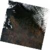
AL1_OPER_AV2_OBS_11_20080630T083132_20080630T083142_012957_0259_3680_0000
Download Product | Browse
wrsLongitudeGrid | 259 |
wrsLatitudeGrid | 3680 |
beginAcquisition | 2008-06-30T08:31:32.221Z |
endAcquisition | 2008-06-30T08:31:42.581Z |
productType | AV2_OBS_11 |
instrumentShortName | AVNIR-2 |
operationalMode | OBS |
orbitNumber | 12957 |
orbitDirection | DESCENDING |
sceneCentre | -3.982 28.128 |
acquisitionStation | SGS |
cloudCoverPercentage | 0 |
sceneId | AV2A129573680 |
AL1_OPER_AV2_OBS_11_20090720T083831_20090720T083841_018573_0260_3680_0000
Download Product | Browse
wrsLongitudeGrid | 260 |
wrsLatitudeGrid | 3680 |
beginAcquisition | 2009-07-20T08:38:31.269Z |
endAcquisition | 2009-07-20T08:38:41.629Z |
productType | AV2_OBS_11 |
instrumentShortName | AVNIR-2 |
operationalMode | OBS |
orbitNumber | 18573 |
orbitDirection | DESCENDING |
sceneCentre | -3.981 27.589 |
acquisitionStation | SGS |
cloudCoverPercentage | 0 |
sceneId | AV2A185733680 |