
Static Map Catalogue - Product List
back to previous node |
list of download URLs

Collection ALOS_Africa_AVNIR2
ALOS AVNIR-2 African Coverage ESA archive. More information can be found on this page.
List of available products (latitude from -4.34444 to -3.44815 dg, longitude from 22.3625 to 23.3708 dg)..
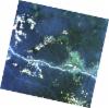
AL1_OPER_AV2_OBS_11_20080616T085305_20080616T085315_012753_0269_3670_0000
Download Product | Browse
wrsLongitudeGrid | 269 |
wrsLatitudeGrid | 3670 |
beginAcquisition | 2008-06-16T08:53:05.620Z |
endAcquisition | 2008-06-16T08:53:15.980Z |
productType | AV2_OBS_11 |
instrumentShortName | AVNIR-2 |
operationalMode | OBS |
orbitNumber | 12753 |
orbitDirection | DESCENDING |
sceneCentre | -3.507 22.793 |
acquisitionStation | SGS |
cloudCoverPercentage | 0 |
sceneId | AV2A127533670 |
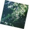
AL1_OPER_AV2_OBS_11_20080616T085313_20080616T085324_012753_0269_3680_0000
Download Product | Browse
wrsLongitudeGrid | 269 |
wrsLatitudeGrid | 3680 |
beginAcquisition | 2008-06-16T08:53:13.843Z |
endAcquisition | 2008-06-16T08:53:24.203Z |
productType | AV2_OBS_11 |
instrumentShortName | AVNIR-2 |
operationalMode | OBS |
orbitNumber | 12753 |
orbitDirection | DESCENDING |
sceneCentre | -4.005 22.687 |
acquisitionStation | SGS |
cloudCoverPercentage | 0 |
sceneId | AV2A127533680 |
AL1_OPER_AV2_OBS_11_20090302T085436_20090302T085447_016531_0268_3680_0000
Download Product | Browse
wrsLongitudeGrid | 268 |
wrsLatitudeGrid | 3680 |
beginAcquisition | 2009-03-02T08:54:36.969Z |
endAcquisition | 2009-03-02T08:54:47.329Z |
productType | AV2_OBS_11 |
instrumentShortName | AVNIR-2 |
operationalMode | OBS |
orbitNumber | 16531 |
orbitDirection | DESCENDING |
sceneCentre | -3.982 23.295 |
acquisitionStation | SGS |
cloudCoverPercentage | 0 |
sceneId | AV2A165313680 |