
Static Map Catalogue - Product List
back to previous node |
list of download URLs


Collection ALOS_Africa_AVNIR2
ALOS AVNIR-2 African Coverage ESA archive. More information can be found on this page.
List of available products (latitude from -4.34444 to -3.44815 dg, longitude from 18.8792 to 19.8875 dg)..
AL1_OPER_AV2_OBS_11_20080626T090551_20080626T090601_012899_0275_3680_0000
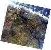
Download Product | Browse
wrsLongitudeGrid | 275 |
wrsLatitudeGrid | 3680 |
beginAcquisition | 2008-06-26T09:05:51.118Z |
endAcquisition | 2008-06-26T09:06:01.478Z |
productType | AV2_OBS_11 |
instrumentShortName | AVNIR-2 |
operationalMode | OBS |
orbitNumber | 12899 |
orbitDirection | DESCENDING |
sceneCentre | -3.982 19.546 |
acquisitionStation | SGS |
cloudCoverPercentage | 0 |
sceneId | AV2A128993680 |
AL1_OPER_AV2_OBS_11_20080828T090846_20080828T090856_013818_0276_3680_0000
Download Product | Browse
wrsLongitudeGrid | 276 |
wrsLatitudeGrid | 3680 |
beginAcquisition | 2008-08-28T09:08:46.450Z |
endAcquisition | 2008-08-28T09:08:56.810Z |
productType | AV2_OBS_11 |
instrumentShortName | AVNIR-2 |
operationalMode | OBS |
orbitNumber | 13818 |
orbitDirection | DESCENDING |
sceneCentre | -3.982 18.997 |
acquisitionStation | SGS |
cloudCoverPercentage | 0 |
sceneId | AV2A138183680 |
AL1_OPER_AV2_OBS_11_20080926T090703_20080926T090713_014241_0275_3670_0000
Download Product | Browse
wrsLongitudeGrid | 275 |
wrsLatitudeGrid | 3670 |
beginAcquisition | 2008-09-26T09:07:03.017Z |
endAcquisition | 2008-09-26T09:07:13.377Z |
productType | AV2_OBS_11 |
instrumentShortName | AVNIR-2 |
operationalMode | OBS |
orbitNumber | 14241 |
orbitDirection | DESCENDING |
sceneCentre | -3.484 19.648 |
acquisitionStation | SGS |
cloudCoverPercentage | 1 |
sceneId | AV2A142413670 |