
Static Map Catalogue - Product List
back to previous node |
list of download URLs


Collection ALOS_Africa_AVNIR2
ALOS AVNIR-2 African Coverage ESA archive. More information can be found on this page.
List of available products (latitude from -4.34444 to -3.44815 dg, longitude from 17.8708 to 18.8792 dg)..
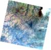
AL1_OPER_AV2_OBS_11_20070728T091335_20070728T091346_008027_0277_3680_0000
Download Product | Browse
wrsLongitudeGrid | 277 |
wrsLatitudeGrid | 3680 |
beginAcquisition | 2007-07-28T09:13:35.640Z |
endAcquisition | 2007-07-28T09:13:46.000Z |
productType | AV2_OBS_11 |
instrumentShortName | AVNIR-2 |
operationalMode | OBS |
orbitNumber | 8027 |
orbitDirection | DESCENDING |
sceneCentre | -3.983 18.470 |
acquisitionStation | SGS |
cloudCoverPercentage | 0 |
sceneId | AV2A080273680 |
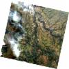
AL1_OPER_AV2_OBS_11_20070728T091327_20070728T091337_008027_0277_3670_0000
Download Product | Browse
wrsLongitudeGrid | 277 |
wrsLatitudeGrid | 3670 |
beginAcquisition | 2007-07-28T09:13:27.414Z |
endAcquisition | 2007-07-28T09:13:37.774Z |
productType | AV2_OBS_11 |
instrumentShortName | AVNIR-2 |
operationalMode | OBS |
orbitNumber | 8027 |
orbitDirection | DESCENDING |
sceneCentre | -3.483 18.576 |
acquisitionStation | SGS |
cloudCoverPercentage | 0 |
sceneId | AV2A080273670 |
AL1_OPER_AV2_OBS_11_20080516T091243_20080516T091253_012301_0278_3680_0000
Download Product | Browse
wrsLongitudeGrid | 278 |
wrsLatitudeGrid | 3680 |
beginAcquisition | 2008-05-16T09:12:43.294Z |
endAcquisition | 2008-05-16T09:12:53.654Z |
productType | AV2_OBS_11 |
instrumentShortName | AVNIR-2 |
operationalMode | OBS |
orbitNumber | 12301 |
orbitDirection | DESCENDING |
sceneCentre | -3.983 17.938 |
acquisitionStation | SGS |
cloudCoverPercentage | 0 |
sceneId | AV2A123013680 |
AL1_OPER_AV2_OBS_11_20090704T091654_20090704T091704_018340_0278_3670_0000
Download Product | Browse
wrsLongitudeGrid | 278 |
wrsLatitudeGrid | 3670 |
beginAcquisition | 2009-07-04T09:16:54.116Z |
endAcquisition | 2009-07-04T09:17:04.476Z |
productType | AV2_OBS_11 |
instrumentShortName | AVNIR-2 |
operationalMode | OBS |
orbitNumber | 18340 |
orbitDirection | DESCENDING |
sceneCentre | -3.483 18.040 |
acquisitionStation | SGS |
cloudCoverPercentage | 0 |
sceneId | AV2A183403670 |