
Static Map Catalogue - Product List
back to previous node |
list of download URLs


Collection ALOS_Africa_AVNIR2
ALOS AVNIR-2 African Coverage ESA archive. More information can be found on this page.
List of available products (latitude from -4.9963 to -4.1 dg, longitude from 30.1208 to 31.1292 dg)..
AL1_OPER_AV2_OBS_11_20060817T082241_20060817T082251_002994_0254_3690_0000
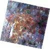
Download Product | Browse
wrsLongitudeGrid | 254 |
wrsLatitudeGrid | 3690 |
beginAcquisition | 2006-08-17T08:22:41.059Z |
endAcquisition | 2006-08-17T08:22:51.419Z |
productType | AV2_OBS_11 |
instrumentShortName | AVNIR-2 |
operationalMode | OBS |
orbitNumber | 2994 |
orbitDirection | DESCENDING |
sceneCentre | -4.481 30.714 |
acquisitionStation | SGS |
cloudCoverPercentage | 0 |
sceneId | AV2A029943690 |
AL1_OPER_AV2_OBS_11_20060817T082249_20060817T082259_002994_0254_3700_0000
Download Product | Browse
wrsLongitudeGrid | 254 |
wrsLatitudeGrid | 3700 |
beginAcquisition | 2006-08-17T08:22:49.285Z |
endAcquisition | 2006-08-17T08:22:59.645Z |
productType | AV2_OBS_11 |
instrumentShortName | AVNIR-2 |
operationalMode | OBS |
orbitNumber | 2994 |
orbitDirection | DESCENDING |
sceneCentre | -4.978 30.608 |
acquisitionStation | SGS |
cloudCoverPercentage | 0 |
sceneId | AV2A029943700 |
AL1_OPER_AV2_OBS_11_20061019T082535_20061019T082545_003913_0255_3690_0000
Download Product | Browse
wrsLongitudeGrid | 255 |
wrsLatitudeGrid | 3690 |
beginAcquisition | 2006-10-19T08:25:35.388Z |
endAcquisition | 2006-10-19T08:25:45.748Z |
productType | AV2_OBS_11 |
instrumentShortName | AVNIR-2 |
operationalMode | OBS |
orbitNumber | 3913 |
orbitDirection | DESCENDING |
sceneCentre | -4.480 30.179 |
acquisitionStation | SGS |
cloudCoverPercentage | 0 |
sceneId | AV2A039133690 |