
Static Map Catalogue - Product List
back to previous node |
list of download URLs


Collection ALOS_Africa_AVNIR2
ALOS AVNIR-2 African Coverage ESA archive. More information can be found on this page.
List of available products (latitude from -4.9963 to -4.1 dg, longitude from 29.1125 to 30.1208 dg)..
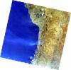
AL1_OPER_AV2_OBS_11_20061019T082543_20061019T082553_003913_0255_3700_0000
Download Product | Browse
wrsLongitudeGrid | 255 |
wrsLatitudeGrid | 3700 |
beginAcquisition | 2006-10-19T08:25:43.614Z |
endAcquisition | 2006-10-19T08:25:53.974Z |
productType | AV2_OBS_11 |
instrumentShortName | AVNIR-2 |
operationalMode | OBS |
orbitNumber | 3913 |
orbitDirection | DESCENDING |
sceneCentre | -4.979 30.073 |
acquisitionStation | SGS |
cloudCoverPercentage | 0 |
sceneId | AV2A039133700 |
AL1_OPER_AV2_OBS_11_20070808T082845_20070808T082856_008187_0256_3700_0000
Download Product | Browse
wrsLongitudeGrid | 256 |
wrsLatitudeGrid | 3700 |
beginAcquisition | 2007-08-08T08:28:45.909Z |
endAcquisition | 2007-08-08T08:28:56.269Z |
productType | AV2_OBS_11 |
instrumentShortName | AVNIR-2 |
operationalMode | OBS |
orbitNumber | 8187 |
orbitDirection | DESCENDING |
sceneCentre | -4.979 29.526 |
acquisitionStation | SGS |
cloudCoverPercentage | 2 |
sceneId | AV2A081873700 |
AL1_OPER_AV2_OBS_11_20080810T082535_20080810T082545_013555_0256_3690_0000
Download Product | Browse
wrsLongitudeGrid | 256 |
wrsLatitudeGrid | 3690 |
beginAcquisition | 2008-08-10T08:25:35.310Z |
endAcquisition | 2008-08-10T08:25:45.670Z |
productType | AV2_OBS_11 |
instrumentShortName | AVNIR-2 |
operationalMode | OBS |
orbitNumber | 13555 |
orbitDirection | DESCENDING |
sceneCentre | -4.478 29.623 |
acquisitionStation | SGS |
cloudCoverPercentage | 0 |
sceneId | AV2A135553690 |