
Static Map Catalogue - Product List
back to previous node |
list of download URLs


Collection ALOS_Africa_AVNIR2
ALOS AVNIR-2 African Coverage ESA archive. More information can be found on this page.
List of available products (latitude from -4.9963 to -4.1 dg, longitude from 16.8625 to 17.8708 dg)..
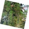
AL1_OPER_AV2_OBS_11_20071016T091739_20071016T091750_009194_0279_3690_0000
Download Product | Browse
wrsLongitudeGrid | 279 |
wrsLatitudeGrid | 3690 |
beginAcquisition | 2007-10-16T09:17:39.710Z |
endAcquisition | 2007-10-16T09:17:50.070Z |
productType | AV2_OBS_11 |
instrumentShortName | AVNIR-2 |
operationalMode | OBS |
orbitNumber | 9194 |
orbitDirection | DESCENDING |
sceneCentre | -4.481 17.294 |
acquisitionStation | SGS |
cloudCoverPercentage | 0 |
sceneId | AV2A091943690 |
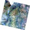
AL1_OPER_AV2_OBS_11_20080516T091251_20080516T091301_012301_0278_3690_0000
Download Product | Browse
wrsLongitudeGrid | 278 |
wrsLatitudeGrid | 3690 |
beginAcquisition | 2008-05-16T09:12:51.520Z |
endAcquisition | 2008-05-16T09:13:01.880Z |
productType | AV2_OBS_11 |
instrumentShortName | AVNIR-2 |
operationalMode | OBS |
orbitNumber | 12301 |
orbitDirection | DESCENDING |
sceneCentre | -4.481 17.832 |
acquisitionStation | SGS |
cloudCoverPercentage | 0 |
sceneId | AV2A123013690 |
AL1_OPER_AV2_OBS_11_20080516T091259_20080516T091310_012301_0278_3700_0000
Download Product | Browse
wrsLongitudeGrid | 278 |
wrsLatitudeGrid | 3700 |
beginAcquisition | 2008-05-16T09:12:59.746Z |
endAcquisition | 2008-05-16T09:13:10.106Z |
productType | AV2_OBS_11 |
instrumentShortName | AVNIR-2 |
operationalMode | OBS |
orbitNumber | 12301 |
orbitDirection | DESCENDING |
sceneCentre | -4.980 17.727 |
acquisitionStation | SGS |
cloudCoverPercentage | 0 |
sceneId | AV2A123013700 |
AL1_OPER_AV2_OBS_11_20090721T091934_20090721T091945_018588_0279_3700_0000
Download Product | Browse
wrsLongitudeGrid | 279 |
wrsLatitudeGrid | 3700 |
beginAcquisition | 2009-07-21T09:19:34.735Z |
endAcquisition | 2009-07-21T09:19:45.095Z |
productType | AV2_OBS_11 |
instrumentShortName | AVNIR-2 |
operationalMode | OBS |
orbitNumber | 18588 |
orbitDirection | DESCENDING |
sceneCentre | -4.979 17.183 |
acquisitionStation | SGS |
cloudCoverPercentage | 0 |
sceneId | AV2A185883700 |