
Static Map Catalogue - Product List
back to previous node |
list of download URLs

Collection ALOS_Africa_AVNIR2
ALOS AVNIR-2 African Coverage ESA archive. More information can be found on this page.
List of available products (latitude from -4.9963 to -4.1 dg, longitude from 15.1208 to 16.1292 dg)..
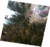
AL1_OPER_AV2_OBS_11_20070322T092642_20070322T092653_006160_0283_3690_0000
Download Product | Browse
wrsLongitudeGrid | 283 |
wrsLatitudeGrid | 3690 |
beginAcquisition | 2007-03-22T09:26:42.904Z |
endAcquisition | 2007-03-22T09:26:53.264Z |
productType | AV2_OBS_11 |
instrumentShortName | AVNIR-2 |
operationalMode | OBS |
orbitNumber | 6160 |
orbitDirection | DESCENDING |
sceneCentre | -4.480 15.145 |
acquisitionStation | SGS |
cloudCoverPercentage | 0 |
sceneId | AV2A061603690 |
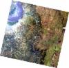
AL1_OPER_AV2_OBS_11_20080907T092158_20080907T092209_013964_0282_3690_0000
Download Product | Browse
wrsLongitudeGrid | 282 |
wrsLatitudeGrid | 3690 |
beginAcquisition | 2008-09-07T09:21:58.922Z |
endAcquisition | 2008-09-07T09:22:09.282Z |
productType | AV2_OBS_11 |
instrumentShortName | AVNIR-2 |
operationalMode | OBS |
orbitNumber | 13964 |
orbitDirection | DESCENDING |
sceneCentre | -4.480 15.676 |
acquisitionStation | SGS |
cloudCoverPercentage | 0 |
sceneId | AV2A139643690 |
AL1_OPER_AV2_OBS_11_20080907T092207_20080907T092217_013964_0282_3700_0000
Download Product | Browse
wrsLongitudeGrid | 282 |
wrsLatitudeGrid | 3700 |
beginAcquisition | 2008-09-07T09:22:07.149Z |
endAcquisition | 2008-09-07T09:22:17.509Z |
productType | AV2_OBS_11 |
instrumentShortName | AVNIR-2 |
operationalMode | OBS |
orbitNumber | 13964 |
orbitDirection | DESCENDING |
sceneCentre | -4.979 15.570 |
acquisitionStation | SGS |
cloudCoverPercentage | 0 |
sceneId | AV2A139643700 |