
Static Map Catalogue - Product List
back to previous node |
list of download URLs

Collection ALOS_Africa_AVNIR2
ALOS AVNIR-2 African Coverage ESA archive. More information can be found on this page.
List of available products (latitude from -5.89259 to -4.9963 dg, longitude from 26.1208 to 27.1292 dg)..
AL1_OPER_AV2_OBS_11_20080404T083932_20080404T083942_011688_0262_3710_0000
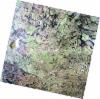
Download Product | Browse
wrsLongitudeGrid | 262 |
wrsLatitudeGrid | 3710 |
beginAcquisition | 2008-04-04T08:39:32.096Z |
endAcquisition | 2008-04-04T08:39:42.456Z |
productType | AV2_OBS_11 |
instrumentShortName | AVNIR-2 |
operationalMode | OBS |
orbitNumber | 11688 |
orbitDirection | DESCENDING |
sceneCentre | -5.478 26.206 |
acquisitionStation | SGS |
cloudCoverPercentage | 0 |
sceneId | AV2A116883710 |
AL1_OPER_AV2_OBS_11_20080618T083611_20080618T083622_012782_0261_3710_0000
Download Product | Browse
wrsLongitudeGrid | 261 |
wrsLatitudeGrid | 3710 |
beginAcquisition | 2008-06-18T08:36:11.886Z |
endAcquisition | 2008-06-18T08:36:22.246Z |
productType | AV2_OBS_11 |
instrumentShortName | AVNIR-2 |
operationalMode | OBS |
orbitNumber | 12782 |
orbitDirection | DESCENDING |
sceneCentre | -5.475 26.740 |
acquisitionStation | SGS |
cloudCoverPercentage | 0 |
sceneId | AV2A127823710 |