
Static Map Catalogue - Product List
back to previous node |
list of download URLs
Collection ALOS_Africa_AVNIR2
ALOS AVNIR-2 African Coverage ESA archive. More information can be found on this page.
List of available products (latitude from -5.89259 to -4.9963 dg, longitude from 18.8792 to 19.8875 dg)..
AL1_OPER_AV2_OBS_11_20080626T090615_20080626T090626_012899_0275_3710_0000
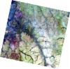
Download Product | Browse
wrsLongitudeGrid | 275 |
wrsLatitudeGrid | 3710 |
beginAcquisition | 2008-06-26T09:06:15.797Z |
endAcquisition | 2008-06-26T09:06:26.157Z |
productType | AV2_OBS_11 |
instrumentShortName | AVNIR-2 |
operationalMode | OBS |
orbitNumber | 12899 |
orbitDirection | DESCENDING |
sceneCentre | -5.476 19.229 |
acquisitionStation | SGS |
cloudCoverPercentage | 0 |
sceneId | AV2A128993710 |