
Static Map Catalogue - Product List
back to previous node |
list of download URLs


Collection ALOS_Africa_AVNIR2
ALOS AVNIR-2 African Coverage ESA archive. More information can be found on this page.
List of available products (latitude from -6.78889 to -5.89259 dg, longitude from 30.1208 to 31.1292 dg)..
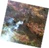
AL1_OPER_AV2_OBS_11_20080505T081949_20080505T081959_012140_0253_3720_0000
Download Product | Browse
wrsLongitudeGrid | 253 |
wrsLatitudeGrid | 3720 |
beginAcquisition | 2008-05-05T08:19:49.100Z |
endAcquisition | 2008-05-05T08:19:59.460Z |
productType | AV2_OBS_11 |
instrumentShortName | AVNIR-2 |
operationalMode | OBS |
orbitNumber | 12140 |
orbitDirection | DESCENDING |
sceneCentre | -5.976 30.928 |
acquisitionStation | SGS |
cloudCoverPercentage | 0 |
sceneId | AV2A121403720 |
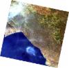
AL1_OPER_AV2_OBS_11_20080505T081957_20080505T082007_012140_0253_3730_0000
Download Product | Browse
wrsLongitudeGrid | 253 |
wrsLatitudeGrid | 3730 |
beginAcquisition | 2008-05-05T08:19:57.327Z |
endAcquisition | 2008-05-05T08:20:07.687Z |
productType | AV2_OBS_11 |
instrumentShortName | AVNIR-2 |
operationalMode | OBS |
orbitNumber | 12140 |
orbitDirection | DESCENDING |
sceneCentre | -6.473 30.822 |
acquisitionStation | SGS |
cloudCoverPercentage | 0 |
sceneId | AV2A121403730 |
AL1_OPER_AV2_OBS_11_20080707T082123_20080707T082133_013059_0254_3720_0000
Download Product | Browse
wrsLongitudeGrid | 254 |
wrsLatitudeGrid | 3720 |
beginAcquisition | 2008-07-07T08:21:23.179Z |
endAcquisition | 2008-07-07T08:21:33.539Z |
productType | AV2_OBS_11 |
instrumentShortName | AVNIR-2 |
operationalMode | OBS |
orbitNumber | 13059 |
orbitDirection | DESCENDING |
sceneCentre | -5.974 30.386 |
acquisitionStation | SGS |
cloudCoverPercentage | 0 |
sceneId | AV2A130593720 |
AL1_OPER_AV2_OBS_11_20080707T082131_20080707T082141_013059_0254_3730_0000
Download Product | Browse
wrsLongitudeGrid | 254 |
wrsLatitudeGrid | 3730 |
beginAcquisition | 2008-07-07T08:21:31.406Z |
endAcquisition | 2008-07-07T08:21:41.766Z |
productType | AV2_OBS_11 |
instrumentShortName | AVNIR-2 |
operationalMode | OBS |
orbitNumber | 13059 |
orbitDirection | DESCENDING |
sceneCentre | -6.473 30.279 |
acquisitionStation | SGS |
cloudCoverPercentage | 0 |
sceneId | AV2A130593730 |