
Static Map Catalogue - Product List
back to previous node |
list of download URLs


Collection ALOS_Africa_AVNIR2
ALOS AVNIR-2 African Coverage ESA archive. More information can be found on this page.
List of available products (latitude from -6.78889 to -5.89259 dg, longitude from 27.8625 to 28.8708 dg)..
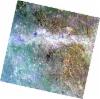
AL1_OPER_AV2_OBS_11_20070727T083330_20070727T083340_008012_0258_3730_0000
Download Product | Browse
wrsLongitudeGrid | 258 |
wrsLatitudeGrid | 3730 |
beginAcquisition | 2007-07-27T08:33:30.454Z |
endAcquisition | 2007-07-27T08:33:40.814Z |
productType | AV2_OBS_11 |
instrumentShortName | AVNIR-2 |
operationalMode | OBS |
orbitNumber | 8012 |
orbitDirection | DESCENDING |
sceneCentre | -6.474 28.134 |
acquisitionStation | SGS |
cloudCoverPercentage | 0 |
sceneId | AV2A080123730 |
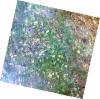
AL1_OPER_AV2_OBS_11_20070825T083107_20070825T083118_008435_0257_3720_0000
Download Product | Browse
wrsLongitudeGrid | 257 |
wrsLatitudeGrid | 3720 |
beginAcquisition | 2007-08-25T08:31:07.971Z |
endAcquisition | 2007-08-25T08:31:18.331Z |
productType | AV2_OBS_11 |
instrumentShortName | AVNIR-2 |
operationalMode | OBS |
orbitNumber | 8435 |
orbitDirection | DESCENDING |
sceneCentre | -5.976 28.779 |
acquisitionStation | SGS |
cloudCoverPercentage | 0 |
sceneId | AV2A084353720 |
AL1_OPER_AV2_OBS_11_20070825T083116_20070825T083126_008435_0257_3730_0000
Download Product | Browse
wrsLongitudeGrid | 257 |
wrsLatitudeGrid | 3730 |
beginAcquisition | 2007-08-25T08:31:16.199Z |
endAcquisition | 2007-08-25T08:31:26.559Z |
productType | AV2_OBS_11 |
instrumentShortName | AVNIR-2 |
operationalMode | OBS |
orbitNumber | 8435 |
orbitDirection | DESCENDING |
sceneCentre | -6.473 28.673 |
acquisitionStation | SGS |
cloudCoverPercentage | 0 |
sceneId | AV2A084353730 |
AL1_OPER_AV2_OBS_11_20080729T083001_20080729T083012_013380_0258_3720_0000
Download Product | Browse
wrsLongitudeGrid | 258 |
wrsLatitudeGrid | 3720 |
beginAcquisition | 2008-07-29T08:30:01.740Z |
endAcquisition | 2008-07-29T08:30:12.100Z |
productType | AV2_OBS_11 |
instrumentShortName | AVNIR-2 |
operationalMode | OBS |
orbitNumber | 13380 |
orbitDirection | DESCENDING |
sceneCentre | -5.975 28.241 |
acquisitionStation | SGS |
cloudCoverPercentage | 0 |
sceneId | AV2A133803720 |