
Static Map Catalogue - Product List
back to previous node |
list of download URLs


Collection ALOS_Africa_AVNIR2
ALOS AVNIR-2 African Coverage ESA archive. More information can be found on this page.
List of available products (latitude from -6.78889 to -5.89259 dg, longitude from 27.1292 to 28.1375 dg)..
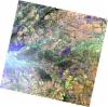
AL1_OPER_AV2_OBS_11_20070727T083330_20070727T083340_008012_0258_3730_0000
Download Product | Browse
wrsLongitudeGrid | 258 |
wrsLatitudeGrid | 3730 |
beginAcquisition | 2007-07-27T08:33:30.454Z |
endAcquisition | 2007-07-27T08:33:40.814Z |
productType | AV2_OBS_11 |
instrumentShortName | AVNIR-2 |
operationalMode | OBS |
orbitNumber | 8012 |
orbitDirection | DESCENDING |
sceneCentre | -6.474 28.134 |
acquisitionStation | SGS |
cloudCoverPercentage | 0 |
sceneId | AV2A080123730 |
AL1_OPER_AV2_OBS_11_20080630T083205_20080630T083215_012957_0259_3720_0000
Download Product | Browse
wrsLongitudeGrid | 259 |
wrsLatitudeGrid | 3720 |
beginAcquisition | 2008-06-30T08:32:05.126Z |
endAcquisition | 2008-06-30T08:32:15.486Z |
productType | AV2_OBS_11 |
instrumentShortName | AVNIR-2 |
operationalMode | OBS |
orbitNumber | 12957 |
orbitDirection | DESCENDING |
sceneCentre | -5.975 27.704 |
acquisitionStation | SGS |
cloudCoverPercentage | 0 |
sceneId | AV2A129573720 |
AL1_OPER_AV2_OBS_11_20080630T083213_20080630T083223_012957_0259_3730_0000
Download Product | Browse
wrsLongitudeGrid | 259 |
wrsLatitudeGrid | 3730 |
beginAcquisition | 2008-06-30T08:32:13.353Z |
endAcquisition | 2008-06-30T08:32:23.713Z |
productType | AV2_OBS_11 |
instrumentShortName | AVNIR-2 |
operationalMode | OBS |
orbitNumber | 12957 |
orbitDirection | DESCENDING |
sceneCentre | -6.473 27.597 |
acquisitionStation | SGS |
cloudCoverPercentage | 0 |
sceneId | AV2A129573730 |
AL1_OPER_AV2_OBS_11_20080717T083417_20080717T083427_013205_0260_3720_0000
Download Product | Browse
wrsLongitudeGrid | 260 |
wrsLatitudeGrid | 3720 |
beginAcquisition | 2008-07-17T08:34:17.392Z |
endAcquisition | 2008-07-17T08:34:27.752Z |
productType | AV2_OBS_11 |
instrumentShortName | AVNIR-2 |
operationalMode | OBS |
orbitNumber | 13205 |
orbitDirection | DESCENDING |
sceneCentre | -5.975 27.167 |
acquisitionStation | SGS |
cloudCoverPercentage | 0 |
sceneId | AV2A132053720 |