
Static Map Catalogue - Product List
back to previous node |
list of download URLs

Collection ALOS_Africa_AVNIR2
ALOS AVNIR-2 African Coverage ESA archive. More information can be found on this page.
List of available products (latitude from -6.78889 to -5.89259 dg, longitude from 25.1125 to 26.1208 dg)..
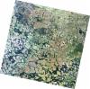
AL1_OPER_AV2_OBS_11_20080404T083940_20080404T083950_011688_0262_3720_0000
Download Product | Browse
wrsLongitudeGrid | 262 |
wrsLatitudeGrid | 3720 |
beginAcquisition | 2008-04-04T08:39:40.322Z |
endAcquisition | 2008-04-04T08:39:50.682Z |
productType | AV2_OBS_11 |
instrumentShortName | AVNIR-2 |
operationalMode | OBS |
orbitNumber | 11688 |
orbitDirection | DESCENDING |
sceneCentre | -5.975 26.100 |
acquisitionStation | SGS |
cloudCoverPercentage | 0 |
sceneId | AV2A116883720 |
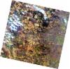
AL1_OPER_AV2_OBS_11_20080820T083914_20080820T083925_013701_0262_3730_0000
Download Product | Browse
wrsLongitudeGrid | 262 |
wrsLatitudeGrid | 3730 |
beginAcquisition | 2008-08-20T08:39:14.712Z |
endAcquisition | 2008-08-20T08:39:25.072Z |
productType | AV2_OBS_11 |
instrumentShortName | AVNIR-2 |
operationalMode | OBS |
orbitNumber | 13701 |
orbitDirection | DESCENDING |
sceneCentre | -6.473 25.976 |
acquisitionStation | SGS |
cloudCoverPercentage | 0 |
sceneId | AV2A137013730 |
AL1_OPER_AV2_OBS_11_20100427T084507_20100427T084517_022672_0263_3720_0000
Download Product | Browse
wrsLongitudeGrid | 263 |
wrsLatitudeGrid | 3720 |
beginAcquisition | 2010-04-27T08:45:07.371Z |
endAcquisition | 2010-04-27T08:45:17.731Z |
productType | AV2_OBS_11 |
instrumentShortName | AVNIR-2 |
operationalMode | OBS |
orbitNumber | 22672 |
orbitDirection | DESCENDING |
sceneCentre | -5.976 25.558 |
acquisitionStation | SGS |
cloudCoverPercentage | 0 |
sceneId | AV2A226723720 |