
Static Map Catalogue - Product List
back to previous node |
list of download URLs


Collection ALOS_Africa_AVNIR2
ALOS AVNIR-2 African Coverage ESA archive. More information can be found on this page.
List of available products (latitude from -6.78889 to -5.89259 dg, longitude from 19.6125 to 20.6208 dg)..
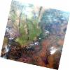
AL1_OPER_AV2_OBS_11_20070723T090742_20070723T090753_007954_0274_3720_0000
Download Product | Browse
wrsLongitudeGrid | 274 |
wrsLatitudeGrid | 3720 |
beginAcquisition | 2007-07-23T09:07:42.727Z |
endAcquisition | 2007-07-23T09:07:53.087Z |
productType | AV2_OBS_11 |
instrumentShortName | AVNIR-2 |
operationalMode | OBS |
orbitNumber | 7954 |
orbitDirection | DESCENDING |
sceneCentre | -5.974 19.657 |
acquisitionStation | SGS |
cloudCoverPercentage | 0 |
sceneId | AV2A079543720 |
AL1_OPER_AV2_OBS_11_20070821T090529_20070821T090539_008377_0273_3720_0000
Download Product | Browse
wrsLongitudeGrid | 273 |
wrsLatitudeGrid | 3720 |
beginAcquisition | 2007-08-21T09:05:29.330Z |
endAcquisition | 2007-08-21T09:05:39.690Z |
productType | AV2_OBS_11 |
instrumentShortName | AVNIR-2 |
operationalMode | OBS |
orbitNumber | 8377 |
orbitDirection | DESCENDING |
sceneCentre | -5.975 20.194 |
acquisitionStation | SGS |
cloudCoverPercentage | 0 |
sceneId | AV2A083773720 |
AL1_OPER_AV2_OBS_11_20070821T090537_20070821T090547_008377_0273_3730_0000
Download Product | Browse
wrsLongitudeGrid | 273 |
wrsLatitudeGrid | 3730 |
beginAcquisition | 2007-08-21T09:05:37.556Z |
endAcquisition | 2007-08-21T09:05:47.916Z |
productType | AV2_OBS_11 |
instrumentShortName | AVNIR-2 |
operationalMode | OBS |
orbitNumber | 8377 |
orbitDirection | DESCENDING |
sceneCentre | -6.473 20.088 |
acquisitionStation | SGS |
cloudCoverPercentage | 0 |
sceneId | AV2A083773730 |