
Static Map Catalogue - Product List
back to previous node |
list of download URLs


Collection ALOS_Africa_AVNIR2
ALOS AVNIR-2 African Coverage ESA archive. More information can be found on this page.
List of available products (latitude from -6.78889 to -5.89259 dg, longitude from 18.8792 to 19.8875 dg)..
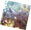
AL1_OPER_AV2_OBS_11_20070723T090750_20070723T090801_007954_0274_3730_0000
Download Product | Browse
wrsLongitudeGrid | 274 |
wrsLatitudeGrid | 3730 |
beginAcquisition | 2007-07-23T09:07:50.954Z |
endAcquisition | 2007-07-23T09:08:01.314Z |
productType | AV2_OBS_11 |
instrumentShortName | AVNIR-2 |
operationalMode | OBS |
orbitNumber | 7954 |
orbitDirection | DESCENDING |
sceneCentre | -6.472 19.551 |
acquisitionStation | SGS |
cloudCoverPercentage | 0 |
sceneId | AV2A079543730 |
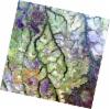
AL1_OPER_AV2_OBS_11_20070723T090742_20070723T090753_007954_0274_3720_0000
Download Product | Browse
wrsLongitudeGrid | 274 |
wrsLatitudeGrid | 3720 |
beginAcquisition | 2007-07-23T09:07:42.727Z |
endAcquisition | 2007-07-23T09:07:53.087Z |
productType | AV2_OBS_11 |
instrumentShortName | AVNIR-2 |
operationalMode | OBS |
orbitNumber | 7954 |
orbitDirection | DESCENDING |
sceneCentre | -5.974 19.657 |
acquisitionStation | SGS |
cloudCoverPercentage | 0 |
sceneId | AV2A079543720 |
AL1_OPER_AV2_OBS_11_20070809T090957_20070809T091007_008202_0275_3730_0000
Download Product | Browse
wrsLongitudeGrid | 275 |
wrsLatitudeGrid | 3730 |
beginAcquisition | 2007-08-09T09:09:57.450Z |
endAcquisition | 2007-08-09T09:10:07.810Z |
productType | AV2_OBS_11 |
instrumentShortName | AVNIR-2 |
operationalMode | OBS |
orbitNumber | 8202 |
orbitDirection | DESCENDING |
sceneCentre | -6.474 19.013 |
acquisitionStation | SGS |
cloudCoverPercentage | 0 |
sceneId | AV2A082023730 |
AL1_OPER_AV2_OBS_11_20080626T090624_20080626T090634_012899_0275_3720_0000
Download Product | Browse
wrsLongitudeGrid | 275 |
wrsLatitudeGrid | 3720 |
beginAcquisition | 2008-06-26T09:06:24.023Z |
endAcquisition | 2008-06-26T09:06:34.383Z |
productType | AV2_OBS_11 |
instrumentShortName | AVNIR-2 |
operationalMode | OBS |
orbitNumber | 12899 |
orbitDirection | DESCENDING |
sceneCentre | -5.975 19.122 |
acquisitionStation | SGS |
cloudCoverPercentage | 0 |
sceneId | AV2A128993720 |