
Static Map Catalogue - Product List
back to previous node |
list of download URLs

Collection ALOS_Africa_AVNIR2
ALOS AVNIR-2 African Coverage ESA archive. More information can be found on this page.
List of available products (latitude from -7.44074 to -6.54444 dg, longitude from 27.1292 to 28.1375 dg)..
AL1_OPER_AV2_OBS_11_20080630T083221_20080630T083231_012957_0259_3740_0000
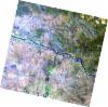
Download Product | Browse
wrsLongitudeGrid | 259 |
wrsLatitudeGrid | 3740 |
beginAcquisition | 2008-06-30T08:32:21.580Z |
endAcquisition | 2008-06-30T08:32:31.940Z |
productType | AV2_OBS_11 |
instrumentShortName | AVNIR-2 |
operationalMode | OBS |
orbitNumber | 12957 |
orbitDirection | DESCENDING |
sceneCentre | -6.970 27.491 |
acquisitionStation | SGS |
cloudCoverPercentage | 0 |
sceneId | AV2A129573740 |
AL1_OPER_AV2_OBS_11_20080729T083018_20080729T083028_013380_0258_3740_0000
Download Product | Browse
wrsLongitudeGrid | 258 |
wrsLatitudeGrid | 3740 |
beginAcquisition | 2008-07-29T08:30:18.197Z |
endAcquisition | 2008-07-29T08:30:28.557Z |
productType | AV2_OBS_11 |
instrumentShortName | AVNIR-2 |
operationalMode | OBS |
orbitNumber | 13380 |
orbitDirection | DESCENDING |
sceneCentre | -6.971 28.028 |
acquisitionStation | SGS |
cloudCoverPercentage | 0 |
sceneId | AV2A133803740 |