
Static Map Catalogue - Product List
back to previous node |
list of download URLs

Collection ALOS_Africa_AVNIR2
ALOS AVNIR-2 African Coverage ESA archive. More information can be found on this page.
List of available products (latitude from -7.44074 to -6.54444 dg, longitude from 16.1292 to 17.1375 dg)..
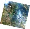
AL1_OPER_AV2_OBS_11_20080619T091721_20080619T091731_012797_0280_3740_0000
Download Product | Browse
wrsLongitudeGrid | 280 |
wrsLatitudeGrid | 3740 |
beginAcquisition | 2008-06-19T09:17:21.234Z |
endAcquisition | 2008-06-19T09:17:31.594Z |
productType | AV2_OBS_11 |
instrumentShortName | AVNIR-2 |
operationalMode | OBS |
orbitNumber | 12797 |
orbitDirection | DESCENDING |
sceneCentre | -6.965 16.229 |
acquisitionStation | SGS |
cloudCoverPercentage | 0 |
sceneId | AV2A127973740 |
AL1_OPER_AV2_OBS_11_20100608T091919_20100608T091929_023285_0279_3740_0000
Download Product | Browse
wrsLongitudeGrid | 279 |
wrsLatitudeGrid | 3740 |
beginAcquisition | 2010-06-08T09:19:19.516Z |
endAcquisition | 2010-06-08T09:19:29.876Z |
productType | AV2_OBS_11 |
instrumentShortName | AVNIR-2 |
operationalMode | OBS |
orbitNumber | 23285 |
orbitDirection | DESCENDING |
sceneCentre | -6.972 16.762 |
acquisitionStation | SGS |
cloudCoverPercentage | 0 |
sceneId | AV2A232853740 |