
Static Map Catalogue - Product List
back to previous node |
list of download URLs


Collection ALOS_Africa_AVNIR2
ALOS AVNIR-2 African Coverage ESA archive. More information can be found on this page.
List of available products (latitude from -9.23333 to -8.33704 dg, longitude from 29.8792 to 30.8875 dg)..
AL1_OPER_AV2_OBS_11_20061014T082021_20061014T082031_003840_0252_3780_0000
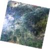
Download Product | Browse
wrsLongitudeGrid | 252 |
wrsLatitudeGrid | 3780 |
beginAcquisition | 2006-10-14T08:20:21.079Z |
endAcquisition | 2006-10-14T08:20:31.439Z |
productType | AV2_OBS_11 |
instrumentShortName | AVNIR-2 |
operationalMode | OBS |
orbitNumber | 3840 |
orbitDirection | DESCENDING |
sceneCentre | -8.963 30.824 |
acquisitionStation | SGS |
cloudCoverPercentage | 0 |
sceneId | AV2A038403780 |
AL1_OPER_AV2_OBS_11_20080505T082030_20080505T082040_012140_0253_3770_0000
Download Product | Browse
wrsLongitudeGrid | 253 |
wrsLatitudeGrid | 3770 |
beginAcquisition | 2008-05-05T08:20:30.238Z |
endAcquisition | 2008-05-05T08:20:40.598Z |
productType | AV2_OBS_11 |
instrumentShortName | AVNIR-2 |
operationalMode | OBS |
orbitNumber | 12140 |
orbitDirection | DESCENDING |
sceneCentre | -8.466 30.396 |
acquisitionStation | SGS |
cloudCoverPercentage | 0 |
sceneId | AV2A121403770 |
AL1_OPER_AV2_OBS_11_20080505T082038_20080505T082048_012140_0253_3780_0000
Download Product | Browse
wrsLongitudeGrid | 253 |
wrsLatitudeGrid | 3780 |
beginAcquisition | 2008-05-05T08:20:38.465Z |
endAcquisition | 2008-05-05T08:20:48.825Z |
productType | AV2_OBS_11 |
instrumentShortName | AVNIR-2 |
operationalMode | OBS |
orbitNumber | 12140 |
orbitDirection | DESCENDING |
sceneCentre | -8.964 30.290 |
acquisitionStation | SGS |
cloudCoverPercentage | 0 |
sceneId | AV2A121403780 |