
Static Map Catalogue - Product List
back to previous node |
list of download URLs

Collection ALOS_Africa_AVNIR2
ALOS AVNIR-2 African Coverage ESA archive. More information can be found on this page.
List of available products (latitude from -9.23333 to -8.33704 dg, longitude from 27.1292 to 28.1375 dg)..
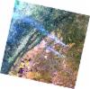
AL1_OPER_AV2_OBS_11_20080515T083312_20080515T083322_012286_0259_3770_0000
Download Product | Browse
wrsLongitudeGrid | 259 |
wrsLatitudeGrid | 3770 |
beginAcquisition | 2008-05-15T08:33:12.038Z |
endAcquisition | 2008-05-15T08:33:22.398Z |
productType | AV2_OBS_11 |
instrumentShortName | AVNIR-2 |
operationalMode | OBS |
orbitNumber | 12286 |
orbitDirection | DESCENDING |
sceneCentre | -8.467 27.178 |
acquisitionStation | SGS |
cloudCoverPercentage | 0 |
sceneId | AV2A122863770 |
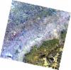
AL1_OPER_AV2_OBS_11_20080729T083042_20080729T083053_013380_0258_3770_0000
Download Product | Browse
wrsLongitudeGrid | 258 |
wrsLatitudeGrid | 3770 |
beginAcquisition | 2008-07-29T08:30:42.884Z |
endAcquisition | 2008-07-29T08:30:53.244Z |
productType | AV2_OBS_11 |
instrumentShortName | AVNIR-2 |
operationalMode | OBS |
orbitNumber | 13380 |
orbitDirection | DESCENDING |
sceneCentre | -8.464 27.708 |
acquisitionStation | SGS |
cloudCoverPercentage | 0 |
sceneId | AV2A133803770 |
AL1_OPER_AV2_OBS_11_20080729T083051_20080729T083101_013380_0258_3780_0000
Download Product | Browse
wrsLongitudeGrid | 258 |
wrsLatitudeGrid | 3780 |
beginAcquisition | 2008-07-29T08:30:51.113Z |
endAcquisition | 2008-07-29T08:31:01.473Z |
productType | AV2_OBS_11 |
instrumentShortName | AVNIR-2 |
operationalMode | OBS |
orbitNumber | 13380 |
orbitDirection | DESCENDING |
sceneCentre | -8.963 27.601 |
acquisitionStation | SGS |
cloudCoverPercentage | 0 |
sceneId | AV2A133803780 |