
Static Map Catalogue - Product List
back to previous node |
list of download URLs


Collection ALOS_Africa_AVNIR2
ALOS AVNIR-2 African Coverage ESA archive. More information can be found on this page.
List of available products (latitude from -9.23333 to -8.33704 dg, longitude from 26.1208 to 27.1292 dg)..
AL1_OPER_AV2_OBS_11_20080515T083320_20080515T083330_012286_0259_3780_0000
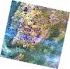
Download Product | Browse
wrsLongitudeGrid | 259 |
wrsLatitudeGrid | 3780 |
beginAcquisition | 2008-05-15T08:33:20.266Z |
endAcquisition | 2008-05-15T08:33:30.626Z |
productType | AV2_OBS_11 |
instrumentShortName | AVNIR-2 |
operationalMode | OBS |
orbitNumber | 12286 |
orbitDirection | DESCENDING |
sceneCentre | -8.964 27.071 |
acquisitionStation | SGS |
cloudCoverPercentage | 0 |
sceneId | AV2A122863780 |
AL1_OPER_AV2_OBS_11_20080717T083506_20080717T083517_013205_0260_3780_0000
Download Product | Browse
wrsLongitudeGrid | 260 |
wrsLatitudeGrid | 3780 |
beginAcquisition | 2008-07-17T08:35:06.762Z |
endAcquisition | 2008-07-17T08:35:17.122Z |
productType | AV2_OBS_11 |
instrumentShortName | AVNIR-2 |
operationalMode | OBS |
orbitNumber | 13205 |
orbitDirection | DESCENDING |
sceneCentre | -8.963 26.527 |
acquisitionStation | SGS |
cloudCoverPercentage | 0 |
sceneId | AV2A132053780 |
AL1_OPER_AV2_OBS_11_20080717T083458_20080717T083508_013205_0260_3770_0000
Download Product | Browse
wrsLongitudeGrid | 260 |
wrsLatitudeGrid | 3770 |
beginAcquisition | 2008-07-17T08:34:58.533Z |
endAcquisition | 2008-07-17T08:35:08.893Z |
productType | AV2_OBS_11 |
instrumentShortName | AVNIR-2 |
operationalMode | OBS |
orbitNumber | 13205 |
orbitDirection | DESCENDING |
sceneCentre | -8.466 26.634 |
acquisitionStation | SGS |
cloudCoverPercentage | 0 |
sceneId | AV2A132053770 |