
Static Map Catalogue - Product List
back to previous node |
list of download URLs

Collection ALOS_Africa_AVNIR2
ALOS AVNIR-2 African Coverage ESA archive. More information can be found on this page.
List of available products (latitude from -9.23333 to -8.33704 dg, longitude from 23.3708 to 24.3792 dg)..
AL1_OPER_AV2_OBS_11_20090614T085223_20090614T085234_018048_0266_3770_0000
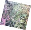
Download Product | Browse
wrsLongitudeGrid | 266 |
wrsLatitudeGrid | 3770 |
beginAcquisition | 2009-06-14T08:52:23.746Z |
endAcquisition | 2009-06-14T08:52:34.106Z |
productType | AV2_OBS_11 |
instrumentShortName | AVNIR-2 |
operationalMode | OBS |
orbitNumber | 18048 |
orbitDirection | DESCENDING |
sceneCentre | -8.465 23.412 |
acquisitionStation | SGS |
cloudCoverPercentage | 0 |
sceneId | AV2A180483770 |
AL1_OPER_AV2_OBS_11_20100415T085020_20100415T085031_022497_0265_3780_0000
Download Product | Browse
wrsLongitudeGrid | 265 |
wrsLatitudeGrid | 3780 |
beginAcquisition | 2010-04-15T08:50:20.995Z |
endAcquisition | 2010-04-15T08:50:31.355Z |
productType | AV2_OBS_11 |
instrumentShortName | AVNIR-2 |
operationalMode | OBS |
orbitNumber | 22497 |
orbitDirection | DESCENDING |
sceneCentre | -8.964 23.846 |
acquisitionStation | SGS |
cloudCoverPercentage | 0 |
sceneId | AV2A224973780 |