
Static Map Catalogue - Product List
back to previous node |
list of download URLs


Collection ALOS_Africa_AVNIR2
ALOS AVNIR-2 African Coverage ESA archive. More information can be found on this page.
List of available products (latitude from -9.23333 to -8.33704 dg, longitude from 19.6125 to 20.6208 dg)..
AL1_OPER_AV2_OBS_11_20070821T090610_20070821T090620_008377_0273_3770_0000
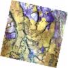
Download Product | Browse
wrsLongitudeGrid | 273 |
wrsLatitudeGrid | 3770 |
beginAcquisition | 2007-08-21T09:06:10.465Z |
endAcquisition | 2007-08-21T09:06:20.825Z |
productType | AV2_OBS_11 |
instrumentShortName | AVNIR-2 |
operationalMode | OBS |
orbitNumber | 8377 |
orbitDirection | DESCENDING |
sceneCentre | -8.466 19.661 |
acquisitionStation | SGS |
cloudCoverPercentage | 0 |
sceneId | AV2A083773770 |
AL1_OPER_AV2_OBS_11_20080621T090036_20080621T090047_012826_0272_3770_0000
Download Product | Browse
wrsLongitudeGrid | 272 |
wrsLatitudeGrid | 3770 |
beginAcquisition | 2008-06-21T09:00:36.892Z |
endAcquisition | 2008-06-21T09:00:47.252Z |
productType | AV2_OBS_11 |
instrumentShortName | AVNIR-2 |
operationalMode | OBS |
orbitNumber | 12826 |
orbitDirection | DESCENDING |
sceneCentre | -8.465 20.202 |
acquisitionStation | SGS |
cloudCoverPercentage | 0 |
sceneId | AV2A128263770 |
AL1_OPER_AV2_OBS_11_20080621T090045_20080621T090055_012826_0272_3780_0000
Download Product | Browse
wrsLongitudeGrid | 272 |
wrsLatitudeGrid | 3780 |
beginAcquisition | 2008-06-21T09:00:45.119Z |
endAcquisition | 2008-06-21T09:00:55.479Z |
productType | AV2_OBS_11 |
instrumentShortName | AVNIR-2 |
operationalMode | OBS |
orbitNumber | 12826 |
orbitDirection | DESCENDING |
sceneCentre | -8.963 20.095 |
acquisitionStation | SGS |
cloudCoverPercentage | 0 |
sceneId | AV2A128263780 |