
Static Map Catalogue - Product List
back to previous node |
list of download URLs


Collection ALOS_Africa_AVNIR2
ALOS AVNIR-2 African Coverage ESA archive. More information can be found on this page.
List of available products (latitude from -9.23333 to -8.33704 dg, longitude from 16.1292 to 17.1375 dg)..
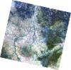
AL1_OPER_AV2_OBS_11_20061013T091809_20061013T091819_003826_0279_3770_0000
Download Product | Browse
wrsLongitudeGrid | 279 |
wrsLatitudeGrid | 3770 |
beginAcquisition | 2006-10-13T09:18:09.038Z |
endAcquisition | 2006-10-13T09:18:19.398Z |
productType | AV2_OBS_11 |
instrumentShortName | AVNIR-2 |
operationalMode | OBS |
orbitNumber | 3826 |
orbitDirection | DESCENDING |
sceneCentre | -8.465 16.444 |
acquisitionStation | SGS |
cloudCoverPercentage | 0 |
sceneId | AV2A038263770 |
AL1_OPER_AV2_OBS_11_20061013T091817_20061013T091827_003826_0279_3780_0000
Download Product | Browse
wrsLongitudeGrid | 279 |
wrsLatitudeGrid | 3780 |
beginAcquisition | 2006-10-13T09:18:17.266Z |
endAcquisition | 2006-10-13T09:18:27.626Z |
productType | AV2_OBS_11 |
instrumentShortName | AVNIR-2 |
operationalMode | OBS |
orbitNumber | 3826 |
orbitDirection | DESCENDING |
sceneCentre | -8.963 16.337 |
acquisitionStation | SGS |
cloudCoverPercentage | 0 |
sceneId | AV2A038263780 |
AL1_OPER_AV2_OBS_11_20080516T091357_20080516T091407_012301_0278_3770_0000
Download Product | Browse
wrsLongitudeGrid | 278 |
wrsLatitudeGrid | 3770 |
beginAcquisition | 2008-05-16T09:13:57.336Z |
endAcquisition | 2008-05-16T09:14:07.696Z |
productType | AV2_OBS_11 |
instrumentShortName | AVNIR-2 |
operationalMode | OBS |
orbitNumber | 12301 |
orbitDirection | DESCENDING |
sceneCentre | -8.467 16.984 |
acquisitionStation | SGS |
cloudCoverPercentage | 0 |
sceneId | AV2A123013770 |
AL1_OPER_AV2_OBS_11_20080516T091405_20080516T091415_012301_0278_3780_0000
Download Product | Browse
wrsLongitudeGrid | 278 |
wrsLatitudeGrid | 3780 |
beginAcquisition | 2008-05-16T09:14:05.564Z |
endAcquisition | 2008-05-16T09:14:15.924Z |
productType | AV2_OBS_11 |
instrumentShortName | AVNIR-2 |
operationalMode | OBS |
orbitNumber | 12301 |
orbitDirection | DESCENDING |
sceneCentre | -8.964 16.877 |
acquisitionStation | SGS |
cloudCoverPercentage | 0 |
sceneId | AV2A123013780 |