
Static Map Catalogue - Product List
back to previous node |
list of download URLs

Collection ALOS_Africa_AVNIR2
ALOS AVNIR-2 African Coverage ESA archive. More information can be found on this page.
List of available products (latitude from -9.88519 to -8.98889 dg, longitude from 23.3708 to 24.3792 dg)..
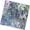
AL1_OPER_AV2_OBS_11_20080623T084343_20080623T084354_012855_0264_3790_0000
Download Product | Browse
wrsLongitudeGrid | 264 |
wrsLatitudeGrid | 3790 |
beginAcquisition | 2008-06-23T08:43:43.780Z |
endAcquisition | 2008-06-23T08:43:54.140Z |
productType | AV2_OBS_11 |
instrumentShortName | AVNIR-2 |
operationalMode | OBS |
orbitNumber | 12855 |
orbitDirection | DESCENDING |
sceneCentre | -9.459 24.279 |
acquisitionStation | SGS |
cloudCoverPercentage | 0 |
sceneId | AV2A128553790 |
AL1_OPER_AV2_OBS_11_20100415T085029_20100415T085039_022497_0265_3790_0000
Download Product | Browse
wrsLongitudeGrid | 265 |
wrsLatitudeGrid | 3790 |
beginAcquisition | 2010-04-15T08:50:29.223Z |
endAcquisition | 2010-04-15T08:50:39.583Z |
productType | AV2_OBS_11 |
instrumentShortName | AVNIR-2 |
operationalMode | OBS |
orbitNumber | 22497 |
orbitDirection | DESCENDING |
sceneCentre | -9.461 23.739 |
acquisitionStation | SGS |
cloudCoverPercentage | 0 |
sceneId | AV2A224973790 |