
Static Map Catalogue - Product List
back to previous node |
list of download URLs
Collection ALOS_Africa_AVNIR2
ALOS AVNIR-2 African Coverage ESA archive. More information can be found on this page.
List of available products (latitude from -9.88519 to -8.98889 dg, longitude from 20.6208 to 21.6292 dg)..
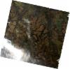
AL1_OPER_AV2_OBS_11_20080501T085510_20080501T085521_012082_0269_3790_0000
Download Product | Browse
wrsLongitudeGrid | 269 |
wrsLatitudeGrid | 3790 |
beginAcquisition | 2008-05-01T08:55:10.654Z |
endAcquisition | 2008-05-01T08:55:21.014Z |
productType | AV2_OBS_11 |
instrumentShortName | AVNIR-2 |
operationalMode | OBS |
orbitNumber | 12082 |
orbitDirection | DESCENDING |
sceneCentre | -9.463 21.600 |
acquisitionStation | SGS |
cloudCoverPercentage | 0 |
sceneId | AV2A120823790 |
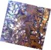
AL1_OPER_AV2_OBS_11_20080703T085640_20080703T085650_013001_0270_3790_0000
Download Product | Browse
wrsLongitudeGrid | 270 |
wrsLatitudeGrid | 3790 |
beginAcquisition | 2008-07-03T08:56:40.022Z |
endAcquisition | 2008-07-03T08:56:50.382Z |
productType | AV2_OBS_11 |
instrumentShortName | AVNIR-2 |
operationalMode | OBS |
orbitNumber | 13001 |
orbitDirection | DESCENDING |
sceneCentre | -9.461 21.054 |
acquisitionStation | SGS |
cloudCoverPercentage | 0 |
sceneId | AV2A130013790 |