
Static Map Catalogue - Product List
back to previous node |
list of download URLs

Collection ALOS_Africa_AVNIR2
ALOS AVNIR-2 African Coverage ESA archive. More information can be found on this page.
List of available products (latitude from -10.7815 to -9.88519 dg, longitude from 18.8792 to 19.8875 dg)..
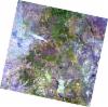
AL1_OPER_AV2_OBS_11_20070821T090635_20070821T090645_008377_0273_3800_0000
Download Product | Browse
wrsLongitudeGrid | 273 |
wrsLatitudeGrid | 3800 |
beginAcquisition | 2007-08-21T09:06:35.149Z |
endAcquisition | 2007-08-21T09:06:45.509Z |
productType | AV2_OBS_11 |
instrumentShortName | AVNIR-2 |
operationalMode | OBS |
orbitNumber | 8377 |
orbitDirection | DESCENDING |
sceneCentre | -9.959 19.340 |
acquisitionStation | SGS |
cloudCoverPercentage | 0 |
sceneId | AV2A083773800 |
AL1_OPER_AV2_OBS_11_20080621T090101_20080621T090111_012826_0272_3800_0000
Download Product | Browse
wrsLongitudeGrid | 272 |
wrsLatitudeGrid | 3800 |
beginAcquisition | 2008-06-21T09:01:01.573Z |
endAcquisition | 2008-06-21T09:01:11.933Z |
productType | AV2_OBS_11 |
instrumentShortName | AVNIR-2 |
operationalMode | OBS |
orbitNumber | 12826 |
orbitDirection | DESCENDING |
sceneCentre | -9.959 19.880 |
acquisitionStation | SGS |
cloudCoverPercentage | 0 |
sceneId | AV2A128263800 |