
Static Map Catalogue - Product List
back to previous node |
list of download URLs


Collection ALOS_Africa_AVNIR2
ALOS AVNIR-2 African Coverage ESA archive. More information can be found on this page.
List of available products (latitude from -10.7815 to -9.88519 dg, longitude from 16.8625 to 17.8708 dg)..
AL1_OPER_AV2_OBS_11_20080614T091216_20080614T091226_012724_0277_3800_0000
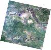
Download Product | Browse
wrsLongitudeGrid | 277 |
wrsLatitudeGrid | 3800 |
beginAcquisition | 2008-06-14T09:12:16.401Z |
endAcquisition | 2008-06-14T09:12:26.761Z |
productType | AV2_OBS_11 |
instrumentShortName | AVNIR-2 |
operationalMode | OBS |
orbitNumber | 12724 |
orbitDirection | DESCENDING |
sceneCentre | -9.989 17.055 |
acquisitionStation | SGS |
cloudCoverPercentage | 0 |
sceneId | AV2A127243800 |
AL1_OPER_AV2_OBS_11_20080614T091224_20080614T091234_012724_0277_3810_0000
Download Product | Browse
wrsLongitudeGrid | 277 |
wrsLatitudeGrid | 3810 |
beginAcquisition | 2008-06-14T09:12:24.631Z |
endAcquisition | 2008-06-14T09:12:34.991Z |
productType | AV2_OBS_11 |
instrumentShortName | AVNIR-2 |
operationalMode | OBS |
orbitNumber | 12724 |
orbitDirection | DESCENDING |
sceneCentre | -10.487 16.947 |
acquisitionStation | SGS |
cloudCoverPercentage | 0 |
sceneId | AV2A127243810 |
AL1_OPER_AV2_OBS_11_20080828T091033_20080828T091043_013818_0276_3810_0000
Download Product | Browse
wrsLongitudeGrid | 276 |
wrsLatitudeGrid | 3810 |
beginAcquisition | 2008-08-28T09:10:33.412Z |
endAcquisition | 2008-08-28T09:10:43.772Z |
productType | AV2_OBS_11 |
instrumentShortName | AVNIR-2 |
operationalMode | OBS |
orbitNumber | 13818 |
orbitDirection | DESCENDING |
sceneCentre | -10.456 17.605 |
acquisitionStation | SGS |
cloudCoverPercentage | 0 |
sceneId | AV2A138183810 |
AL1_OPER_AV2_OBS_11_20100903T091243_20100903T091254_024554_0276_3800_0000
Download Product | Browse
wrsLongitudeGrid | 276 |
wrsLatitudeGrid | 3800 |
beginAcquisition | 2010-09-03T09:12:43.938Z |
endAcquisition | 2010-09-03T09:12:54.298Z |
productType | AV2_OBS_11 |
instrumentShortName | AVNIR-2 |
operationalMode | OBS |
orbitNumber | 24554 |
orbitDirection | DESCENDING |
sceneCentre | -9.961 17.734 |
acquisitionStation | SGS |
cloudCoverPercentage | 0 |
sceneId | AV2A245543800 |