
Static Map Catalogue - Product List
back to previous node |
list of download URLs

Collection ALOS_Africa_AVNIR2
ALOS AVNIR-2 African Coverage ESA archive. More information can be found on this page.
List of available products (latitude from -15.2333 to -14.337 dg, longitude from 15.1208 to 16.1292 dg)..
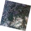
AL1_OPER_AV2_OBS_11_20080701T091511_20080701T091522_012972_0278_3890_0000
Download Product | Browse
wrsLongitudeGrid | 278 |
wrsLatitudeGrid | 3890 |
beginAcquisition | 2008-07-01T09:15:11.824Z |
endAcquisition | 2008-07-01T09:15:22.184Z |
productType | AV2_OBS_11 |
instrumentShortName | AVNIR-2 |
operationalMode | OBS |
orbitNumber | 12972 |
orbitDirection | DESCENDING |
sceneCentre | -14.439 15.674 |
acquisitionStation | SGS |
cloudCoverPercentage | 0 |
sceneId | AV2A129723890 |
AL1_OPER_AV2_OBS_11_20080701T091520_20080701T091530_012972_0278_3900_0000
Download Product | Browse
wrsLongitudeGrid | 278 |
wrsLatitudeGrid | 3900 |
beginAcquisition | 2008-07-01T09:15:20.054Z |
endAcquisition | 2008-07-01T09:15:30.414Z |
productType | AV2_OBS_11 |
instrumentShortName | AVNIR-2 |
operationalMode | OBS |
orbitNumber | 12972 |
orbitDirection | DESCENDING |
sceneCentre | -14.935 15.564 |
acquisitionStation | SGS |
cloudCoverPercentage | 0 |
sceneId | AV2A129723900 |