
Static Map Catalogue - Product List
back to previous node |
list of download URLs

Collection ALOS_Africa_AVNIR2
ALOS AVNIR-2 African Coverage ESA archive. More information can be found on this page.
List of available products (latitude from -20.7741 to -19.8778 dg, longitude from 14.1125 to 15.1208 dg)..
AL1_OPER_AV2_OBS_11_20080701T091642_20080701T091652_012972_0278_4000_0000
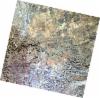
Download Product | Browse
wrsLongitudeGrid | 278 |
wrsLatitudeGrid | 4000 |
beginAcquisition | 2008-07-01T09:16:42.364Z |
endAcquisition | 2008-07-01T09:16:52.724Z |
productType | AV2_OBS_11 |
instrumentShortName | AVNIR-2 |
operationalMode | OBS |
orbitNumber | 12972 |
orbitDirection | DESCENDING |
sceneCentre | -19.907 14.439 |
acquisitionStation | SGS |
cloudCoverPercentage | 0 |
sceneId | AV2A129724000 |
AL1_OPER_AV2_OBS_11_20080701T091650_20080701T091700_012972_0278_4010_0000
Download Product | Browse
wrsLongitudeGrid | 278 |
wrsLatitudeGrid | 4010 |
beginAcquisition | 2008-07-01T09:16:50.595Z |
endAcquisition | 2008-07-01T09:17:00.955Z |
productType | AV2_OBS_11 |
instrumentShortName | AVNIR-2 |
operationalMode | OBS |
orbitNumber | 12972 |
orbitDirection | DESCENDING |
sceneCentre | -20.404 14.324 |
acquisitionStation | SGS |
cloudCoverPercentage | 0 |
sceneId | AV2A129724010 |