
Static Map Catalogue - Product List
back to previous node |
list of download URLs
Collection ALOS_Africa_AVNIR2
ALOS AVNIR-2 African Coverage ESA archive. More information can be found on this page.
List of available products (latitude from 27.5944 to 28.45 dg, longitude from -17.7063 to -16.7437 dg)..
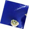
AL1_OPER_AV2_OBS_11_20071008T115603_20071008T115614_009079_0357_3030_0000
Download Product | Browse
wrsLongitudeGrid | 357 |
wrsLatitudeGrid | 3030 |
beginAcquisition | 2007-10-08T11:56:03.810Z |
endAcquisition | 2007-10-08T11:56:14.170Z |
productType | AV2_OBS_11 |
instrumentShortName | AVNIR-2 |
operationalMode | OBS |
orbitNumber | 9079 |
orbitDirection | DESCENDING |
sceneCentre | 28.349 -17.240 |
acquisitionStation | SGS |
cloudCoverPercentage | 0 |
sceneId | AV2A090793030 |
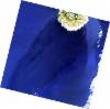
AL1_OPER_AV2_OBS_11_20071008T115612_20071008T115622_009079_0357_3040_0000
Download Product | Browse
wrsLongitudeGrid | 357 |
wrsLatitudeGrid | 3040 |
beginAcquisition | 2007-10-08T11:56:12.027Z |
endAcquisition | 2007-10-08T11:56:22.387Z |
productType | AV2_OBS_11 |
instrumentShortName | AVNIR-2 |
operationalMode | OBS |
orbitNumber | 9079 |
orbitDirection | DESCENDING |
sceneCentre | 27.854 -17.365 |
acquisitionStation | SGS |
cloudCoverPercentage | 0 |
sceneId | AV2A090793040 |