
Static Map Catalogue - Product List
back to previous node |
list of download URLs

Collection ALOS_Africa_AVNIR2
ALOS AVNIR-2 African Coverage ESA archive. More information can be found on this page.
List of available products (latitude from -11.6778 to -10.7815 dg, longitude from 16.8625 to 17.8708 dg)..
AL1_OPER_AV2_OBS_11_20080828T091041_20080828T091052_013818_0276_3820_0000
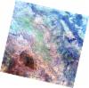
Download Product | Browse
wrsLongitudeGrid | 276 |
wrsLatitudeGrid | 3820 |
beginAcquisition | 2008-08-28T09:10:41.641Z |
endAcquisition | 2008-08-28T09:10:52.001Z |
productType | AV2_OBS_11 |
instrumentShortName | AVNIR-2 |
operationalMode | OBS |
orbitNumber | 13818 |
orbitDirection | DESCENDING |
sceneCentre | -10.953 17.497 |
acquisitionStation | SGS |
cloudCoverPercentage | 0 |
sceneId | AV2A138183820 |
AL1_OPER_AV2_OBS_11_20080828T091049_20080828T091100_013818_0276_3830_0000
Download Product | Browse
wrsLongitudeGrid | 276 |
wrsLatitudeGrid | 3830 |
beginAcquisition | 2008-08-28T09:10:49.869Z |
endAcquisition | 2008-08-28T09:11:00.229Z |
productType | AV2_OBS_11 |
instrumentShortName | AVNIR-2 |
operationalMode | OBS |
orbitNumber | 13818 |
orbitDirection | DESCENDING |
sceneCentre | -11.452 17.388 |
acquisitionStation | SGS |
cloudCoverPercentage | 0 |
sceneId | AV2A138183830 |